Fugro and Autodesk unveil game-changing software integration for smarter, safer construction

Reading Time: < 1 minuteFugro and Autodesk have partnered and launched Fugro’s GeoDin Ground plugin for Autodesk’s Civil 3D software. GeoDin is a comprehensive geotechnical data management software that consolidates various types of subsurface data collected during construction processes. Autodesk is a global leader in building information modelling (BIM) technology for the architecture, engineering, construction, and operations industry. This […]
Teledyne Geospatial to present an exclusive preview of its new coastal mapping solution at HYDRO 2024
Reading Time: < 1 minuteTeledyne Geospatial will showcase an array of their latest advancements in ocean mapping hardware and software solutions at HYDRO 2024, in Rostock-Warnemünde, Germany, November 5-7 At booth 91, Teledyne Geospatial will introduce Fathom, the market”s fastest and most intuitive coastal mapping solution. Fathom is comprised of a lidar sensor for deep and shallow water bathymetry. […]
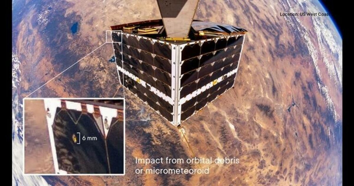
NanoAvionics MP42 satellite survives MMOD impact without ramifications

Reading Time: < 1 minuteSmallsat manufacturer and mission integrator Kongsberg NanoAvionics (“NanoAvionics”) has reported that one of its MP42 microsatellites got hit by a piece of micrometeoroid or orbital debris (MMOD). Despite the 6mm hole, the size of a chickpea, punched into a solar cell, the satellite and its payloads did not experience any ramifications on performance. As its […]
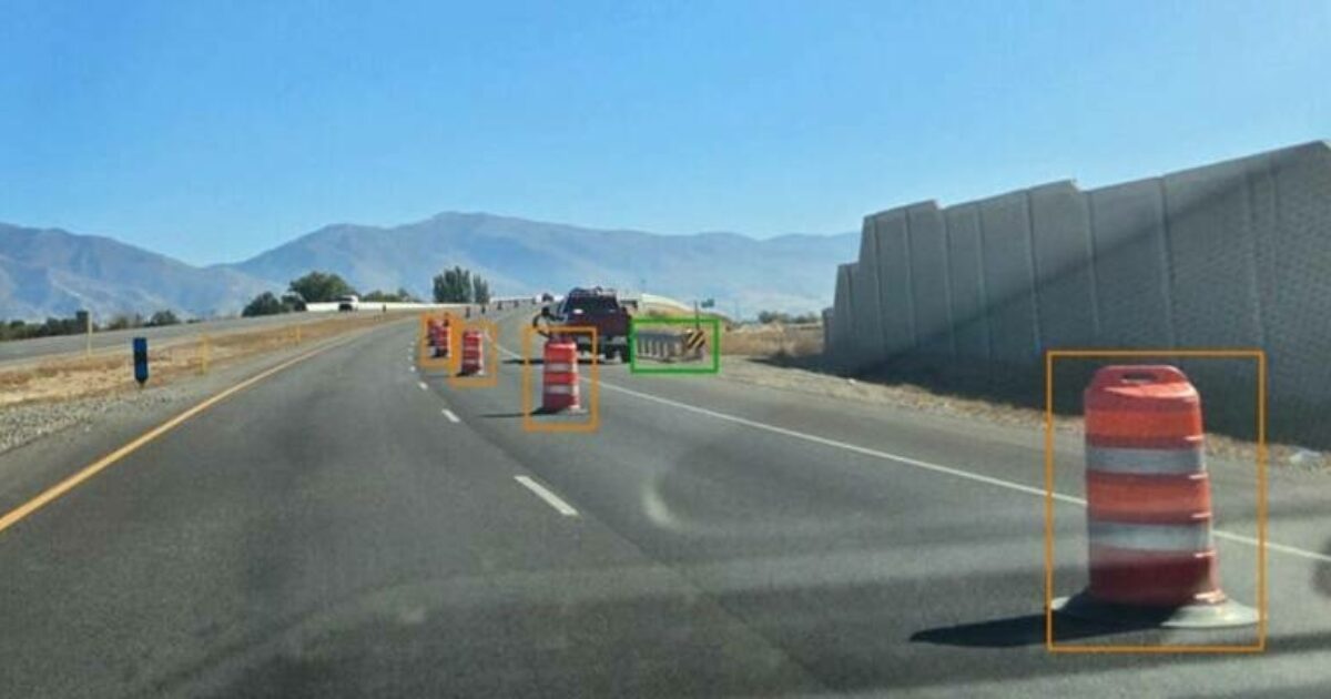
Blyncsy Publishes Map of U.S. Interstate Highways Showing Roadway Assets to Enhance Safety, Maintenance, and Accelerate the Digital Infrastructure Movement Nationally

Reading Time: < 1 minuteBlyncsy empowers state DOTs with the ability to monitor and compare—in near real-time—the status of any major highway in the continental U.S. with their existing data for more informed decision-making. Blyncsy, a Bentley Systems company, announced it published a comprehensive public map of all interstate highways in the continental United States showing key roadway assets […]