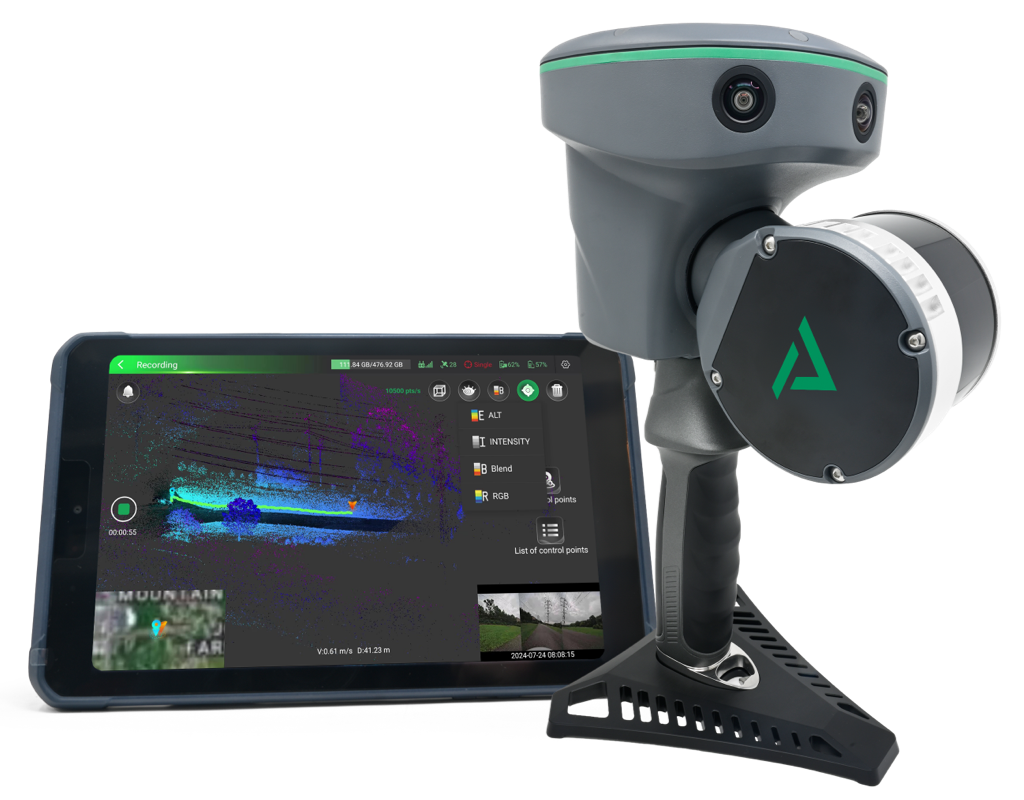
GeoCue Launches LP360 Land Software to Process TrueView GO Handheld LiDAR Data

Reading Time: 3 minutesMaximize Handheld LiDAR Scanning with the All-New LP360 Land Software Huntsville, AL, October 9, 2024 – GeoCue, a leader in geospatial technology, is proud to announce the release of LP360 Land, a new addition to the LP360 software ecosystem designed to elevate handheld LiDAR scanning with the TrueView GO. The TrueView GO, launched in August, […]
Intergeo 2024 through a reporter’s eyes

Reading Time: 5 minutesWhat are the lasting memories after spending three days at Intergeo? Which topics, trends and solutions made the biggest impression? While far from complete, this report is a personal reflection – seen through the eyes of GIM International’s head of content – on the world’s most important gathering of geospatial professionals. This year’s event took […]
Transformative discussions: key takeaways from the Intergeo 2024 press conference

Reading Time: 4 minutesOur industry has a more important role to play than ever in this period of turbulence and societal challenges such as climate change, misinformation and fake news. That was one of the conclusions from the Intergeo 2024 press conference on the second day of the leading trade show and conference for the geospatial industry. Read […]
Harxon puts precision and innovation at the forefront with new GNSS antenna series

Reading Time: 2 minutesHarxon has unveiled a new series of GNSS antennas designed to meet the ever-evolving demands of industries reliant on precise geospatial data. This latest product release includes smart antennas, OEM antennas and a first-ever anti-jamming series, all designed to operate in complex environments with high precision. With its new range of GNSS receivers, Harxon – […]
Innovating land management for Indonesia’s future

Reading Time: 2 minutesKadaster, the Dutch land registry and mapping agency, has been instrumental in modernizing and enhancing land administration in Indonesia through a fruitful partnership with the Ministry of Agrarian Affairs and Spatial Planning, known as ATR/BPN. Over the past four years, this collaboration has significantly contributed to economic growth and improved spatial planning across the nation. […]
YellowScan teams up with DeltaQuad for streamlined Lidar mapping

Reading Time: 2 minutesYellowScan, a global leader in aerial Lidar solutions, has partnered with DeltaQuad, a premier Dutch drone manufacturer, to introduce the Surveyor Ultra, seamlessly integrated into DeltaQuad’s advanced drone technology. This collaboration promises to revolutionize UAV-based LiDAR mapping by significantly boosting productivity and efficiency for large-scale projects. By combining YellowScan’s Surveyor Ultra with the DeltaQuad Evo […]
Leica Geosystems launches lightweight GNSS Smart Antenna with tilt compensation

Reading Time: 2 minutesLeica Geosystems, a division of Hexagon, has launched the Leica GS05, an innovative GNSS Smart Antenna that is both compact and lightweight. This advanced device incorporates calibration-free tilt compensation, making it a fitting solution for surveyors facing demanding tasks and extended working hours. Weighing just 0.75 kilogrammes including the battery, the GS05 significantly reduces operator […]
SimActive Used for Mapping Construction Projects

Reading Time: < 1 minuteSimActive, a developer of photogrammetry software, announces the use of its Correlator3D product in the mapping of large construction projects by US firm Bullseye Construction. The software allows for the creation of accurate map products including DSMs, point clouds and orthomosaics. Bullseye Construction operates its own drone fleet and each site is constantly flown during […]