UP42 and Planet Team Up to Expand the Availability of Frequent-Revisit, Very High Resolution Satellite Data

Reading Time: 2 minutes Berlin, August 27, 2024 – UP42, the leading Earth observation platform, announced a partnership with Planet Labs PBC (NYSE: PL), a global provider of daily satellite imagery and solutions. This collaboration significantly expands UP42’s optical data portfolio with the integration of Planet SkySat, the world’s largest constellation of high resolution Earth observation satellites. With 15 […]
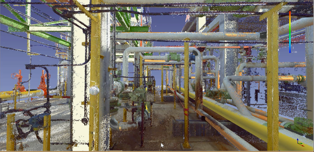
ClearEdge3D Joins AVEVA Partner Ecosystem

Reading Time: 2 minutes Entry into ecosystem will enhance as-built modeling for industrial and process plant professionals Superior, Colorado, August 27, 2024 — ClearEdge3D, a leader in automated 3D modeling and construction verification software, has announced its entry into the AVEVA Partner Ecosystem as an Independent Software Vendor. This partnership reflects ClearEdge3D’s continued commitment to revolutionizing as-built modeling workflows for […]
UP42 and Planet team up to expand the availability of ..

Reading Time: 2 minutes UP42 and Planet team up to expand the availability of frequent-revisit, very high resolution satellite data BERLIN, August 27, 2024 – UP42, the leading Earth observation platform, announced a partnership with Planet Labs PBC (NYSE: PL), a global provider of daily satellite imagery and solutions. This collaboration significantly expands UP42’s optical data portfolio with the integration of […]
Introducing Seamless Integration: IGI CCNS-5 with RIEGL LiDAR Scanners
Reading Time: 3 minutes Kreuztal, Germany and Horn, Austria – Unlock a new era of precision and efficiency in aerial surveying with the seamless integration of IGI CCNS-5 and RIEGL LiDAR Scanners. This powerful combination brings together two industry-leading technologies to deliver unparalleled performance and versatility in data acquisition. The IGI CCNS-5, renowned for its advanced Flight Management System (FMS), seamlessly integrates with RIEGL VQ […]
Satelytics and ACRT Pacific Announce a Breakthrough in Utility Vegetation Management Using AI-Powered Geospatial Analytics
Reading Time: 3 minutes CRT Pacific leveraged Satelytics’ vegetation encroachment algorithms to identify a staggering 57,000 trees presenting a strike risk to electric lines Perrysburg, Ohio – Two companies with expertise in vegetation management, Satelytics, a leader in automated cloud-based geospatial analytics, and ACRT Pacific, a utility vegetation management (UVM) company that provides comprehensive utility solutions on the West […]
Esri honours Crown Estate for ‘Whole of Seabed’ approach

Reading Time: 3 minutes The Crown Estate was recently awarded Esri’s ‘Special Achievement in GIS Award’ for its innovative seabed planning programme across England, Wales and Northern Ireland. This pioneering spatial planning system, developed by The Crown Estate’s Marine and Digital teams, is recognized as a global first. It incorporates data from over 250 sources across ten sectors, enabling […]