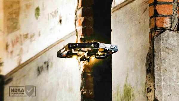
XTEND DEFENSE ACHIEVES FULL NDAA COMPLIANCE ACROSS ITS RANGE OF HUMAN-GUIDED AUTONOMOUS DRONES

Reading Time: 3 minutes XTENDER, Wolverine and Griffon join pool of trusted, NDAA-compliant drones as XTEND expands US operations and ramps up US-based production to fulfil multiple new contracts With over 1,000 US-made drones set to be produced over the next 24 months to equip US Department of Defense and other partners TEL AVIV, Israel and WASHINGTON – At the Modern Day […]
OxTS release OxTS Georeferencer 2.6 ..

Reading Time: 2 minutes OxTS release OxTS Georeferencer 2.6 – now with batch processing OxTS Georeferencer is a software tool developed by OxTS that allows LiDAR surveyors to quickly and simply georeference LiDAR data using the navigation data from both OxTS and 3rd party navigation devices. Packed full of useful features aimed at streamlining the LiDAR survey process, and […]
Hanseatic city of Deventer to welcome FIG Commission 2 and 7

Reading Time: 2 minutes Geospatial professionals and land administration experts are invited to take part in the combined FIG C7/C2 Annual Meeting in Deventer, The Netherlands, proudly hosted by the Netherlands Cadastre, Land Registry and Mapping Agency (Kadaster) and ITC, University of Twente, from 2-4 October 2023. Coupled with the renowned Hanseatic city of Deventer, the Netherlands offers all […]
Bluesky Makes a Record Breaking Start to the 2023 Mapping Flying Season

Reading Time: 2 minutes Aerial mapping company Bluesky International has made a record-breaking start to its 2023 flying season having captured more than 96 per cent of its UK flying target in the first half of the season. Taking advantage of recent clear blue skies, Bluesky has already flown circa 100,000 square kilometres across areas of England, Scotland, Wales […]
CHCNAV presents pioneering new cameras for enhanced aerial photogrammetry

Reading Time: < 1 minute CHC Navigation has introduced the C5 and C30 aerial survey cameras offering more precision and efficiency in aerial photogrammetry. These sophisticated cameras seamlessly integrate with unmanned aerial vehicles (UAVs or ‘drones’) and deliver excellent image quality, enabling professionals to fully leverage the potential of aerial surveying. CHC Navigation (CHCNAV) is a leading provider of geospatial […]